|
GIS - Geographisches Informationssystem
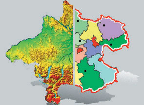
City administrators, planning teams, geographers, surveyors, and statisticians need it: the geographic information system GIS, which can do a great deal more than just generate extremely precise maps. With GIS, statistical and geographic data can be combined and graphically displayed.
Source: Ars Electronica Center
Cross-reference: The right to reprint is reserved for the press; no royalties will be due only with proper copyright attribution.
 download
printversion download
printversion
back
|
|