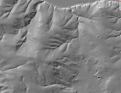
(Linz, November 22, 2010) A systematic aerial laser scan of Upper Austria has been performed over the past few years. What it brought to light were earthen ramparts and trenches, mound graves (tumuli) and roads dating back to epochs long past, beds of long-since-dried-up streams, bomb craters from World War II, and thus many different forms and structures that have been impossible to capture and visualize until now. Kurt Pfleger, the Province of Upper Austria’s DORIS coordinator, and Erwin Kraus, head of remote sensing and engineering geodetics for the Province of Upper Austria, will moderate the next Deep Space LIVE, which will present new and surprising insights into this region’s topography and the historical events linked to it. The featured attractions are digital terrain & surface models … Read more
Digitales Terrain Model des Kürnberg / DORIS / Printversion / Album


